The stop-level data captures wait fractions, boarding pressure, and ETA.
Simulation
Realtime Live section drawing shows continuous architectural state.
No need to use CCTV as DATA
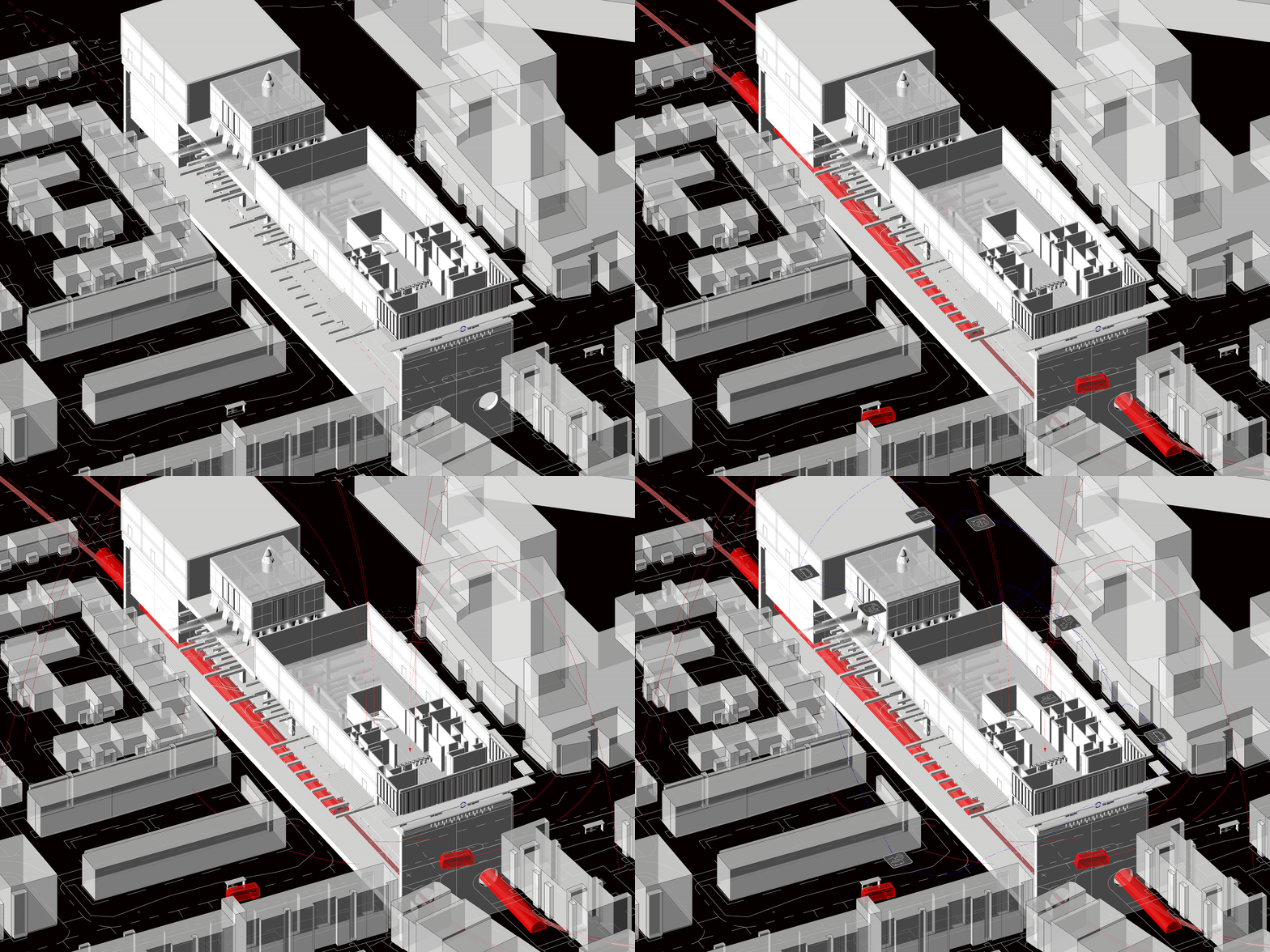
response systems are all interconnected.
Simulation
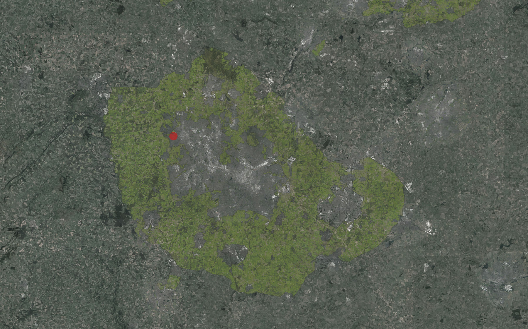
Regional boundary and green-belt context: the project begins with a territorial reading rather than a fixed object.
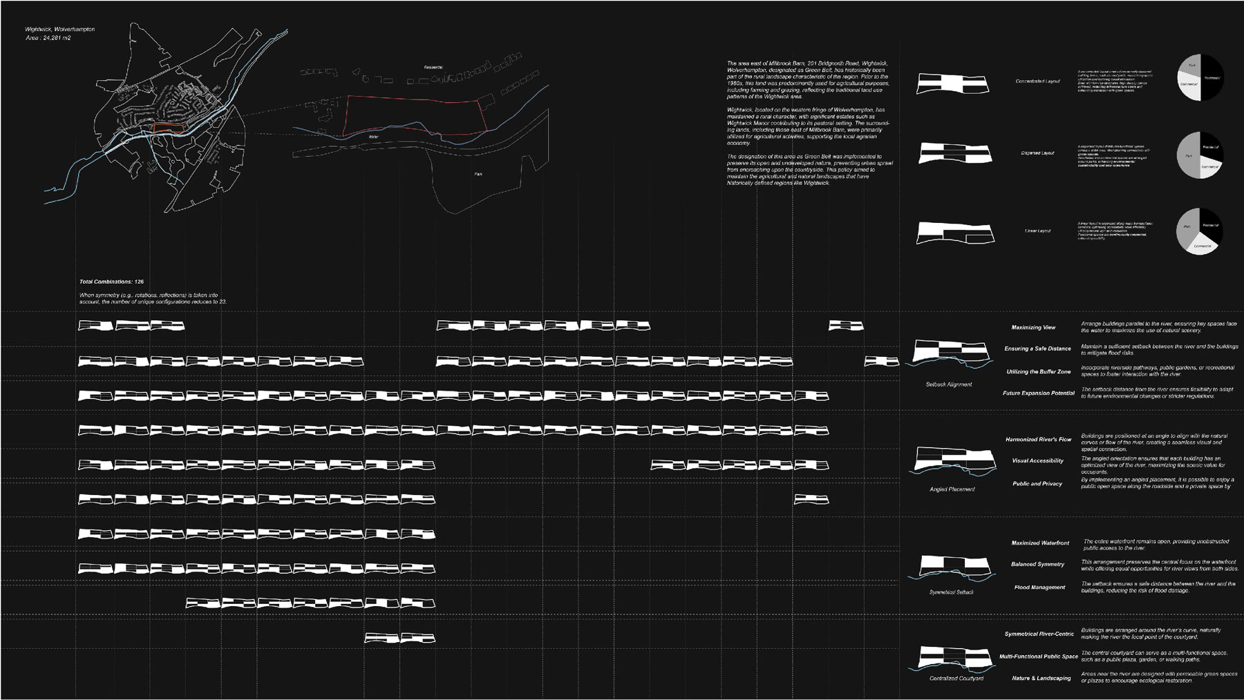
Layout permutations: settlement logics are tested as repeatable rules, constraints, and combinations.
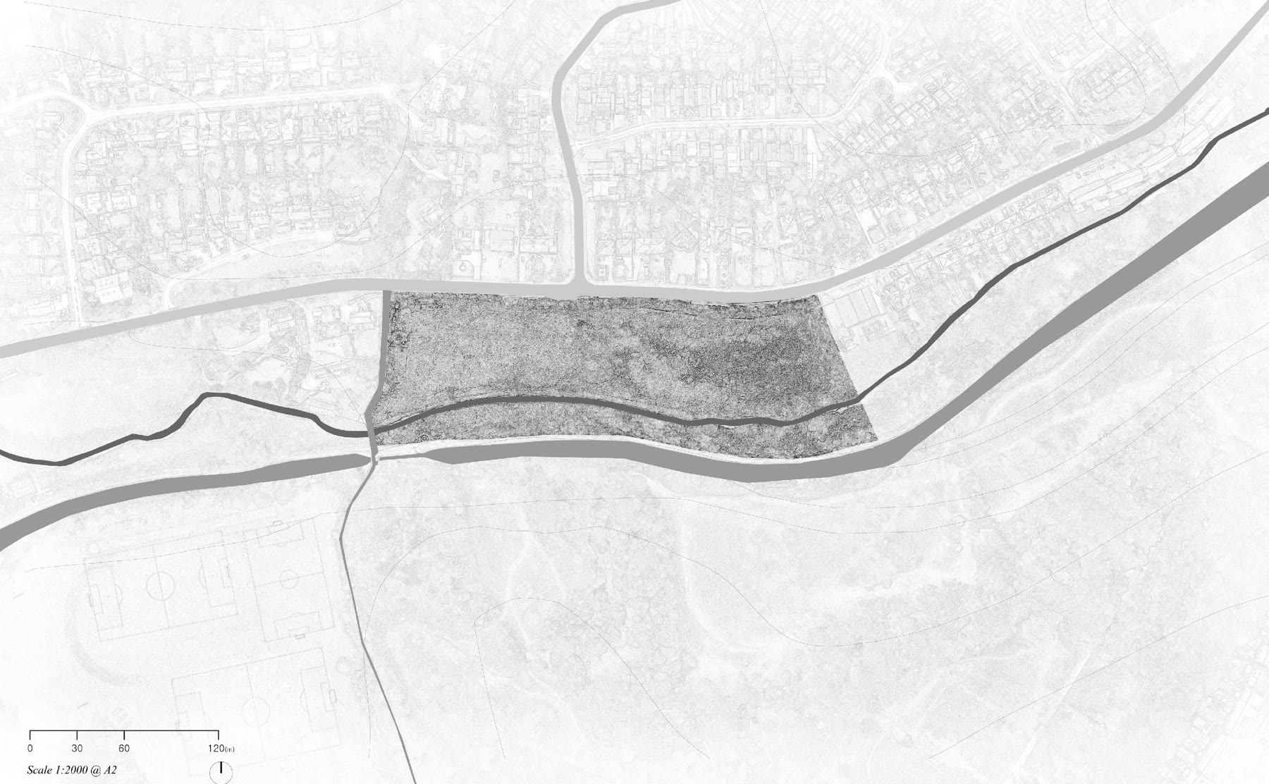
Site condition: river edge, access, existing vegetation, and buildable pressure are treated as active inputs.
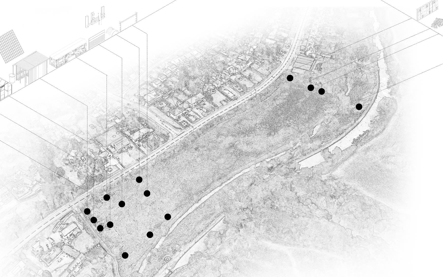
Landscape anchors and distributed occupation zones establish the first spatial network.
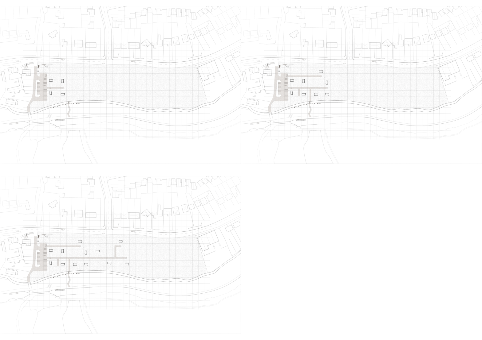
Animated test sequence: incremental occupation is evaluated through changing spatial states.
Animated test sequence: dwelling units and external zones negotiate adjacency and shared use.
Animated test sequence: rule-based growth is read as a planning instrument rather than a final composition.
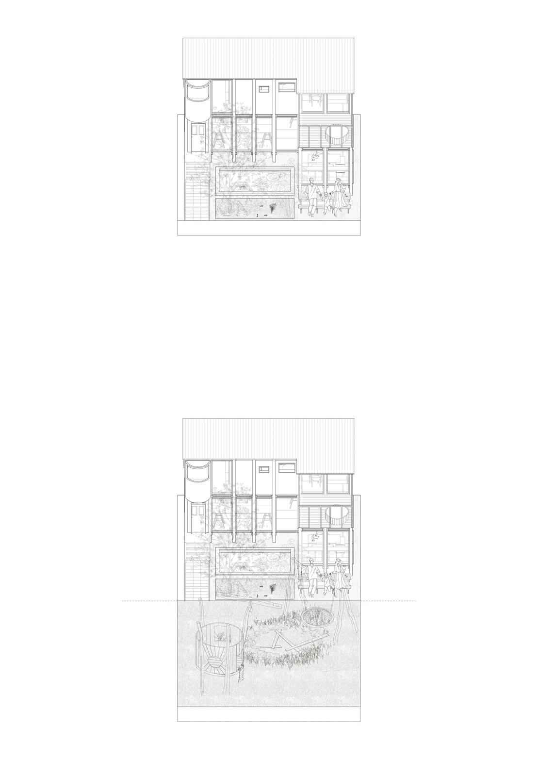
Animated test sequence: the interface compares possible futures under different constraints.
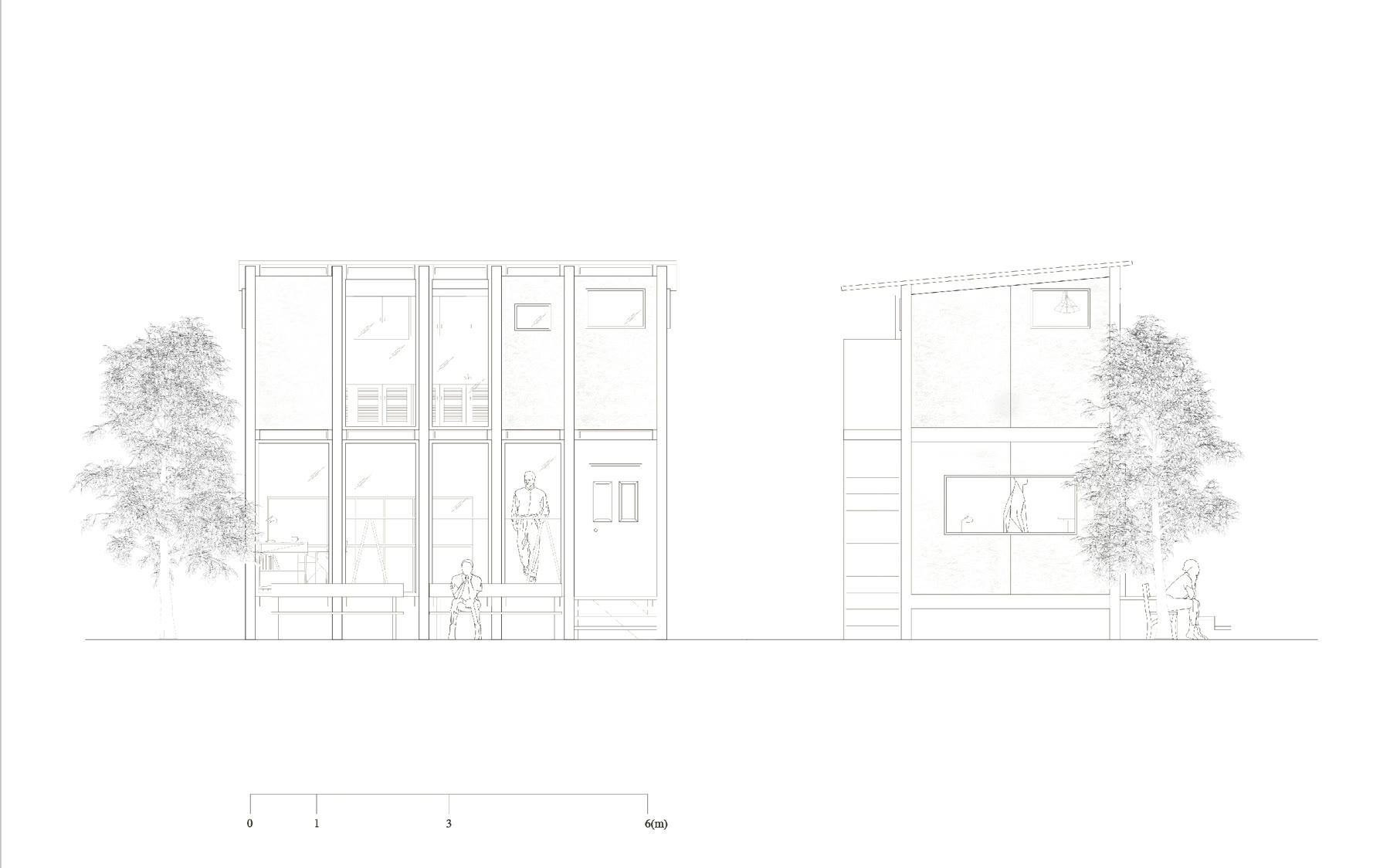
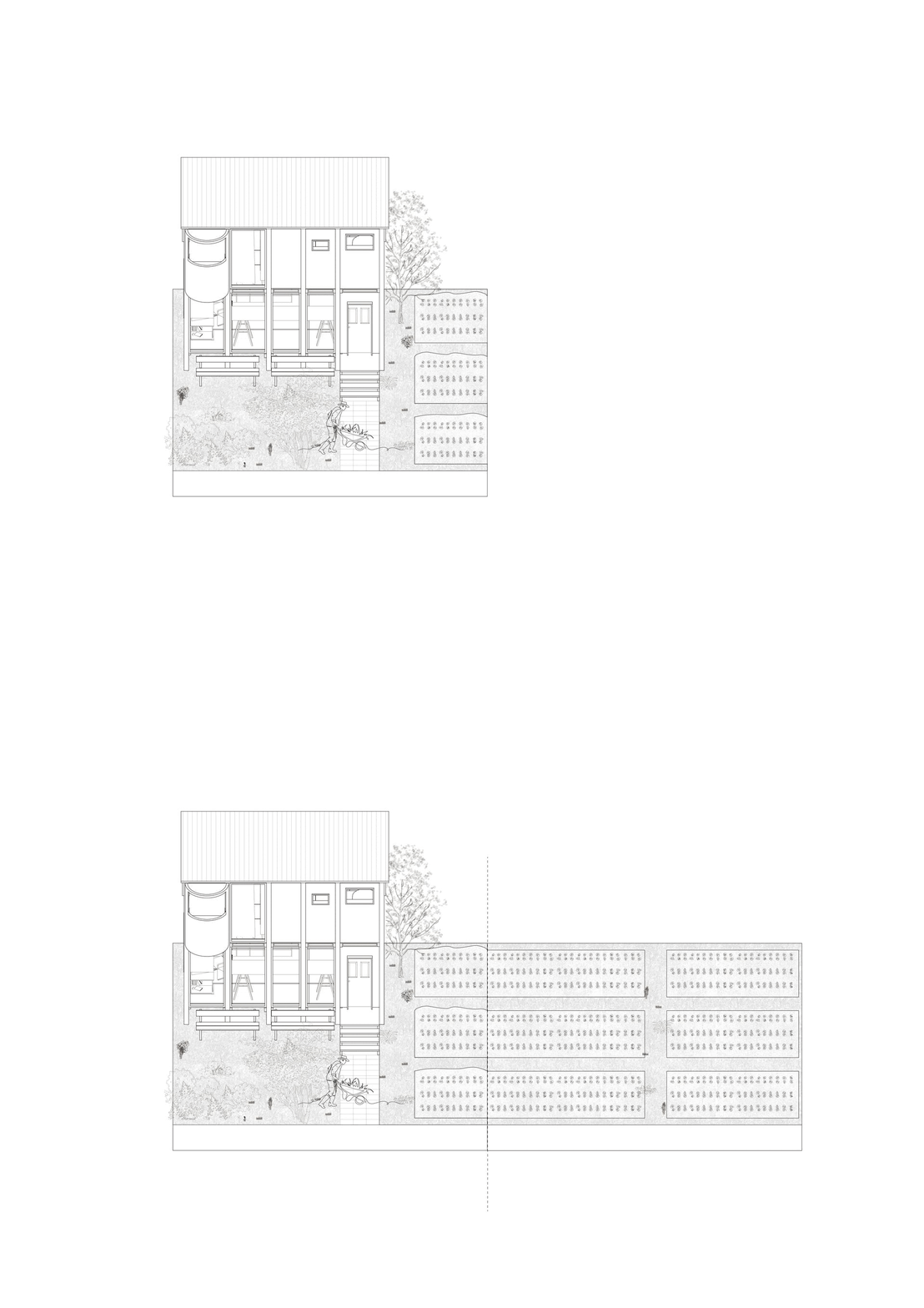
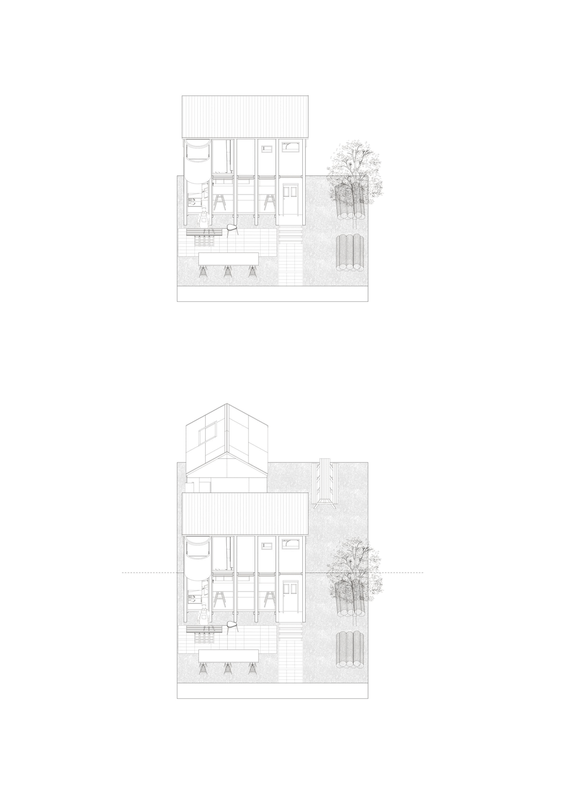
Long section: domestic units, landscape surface, and infrastructural ground are held in one continuous section.
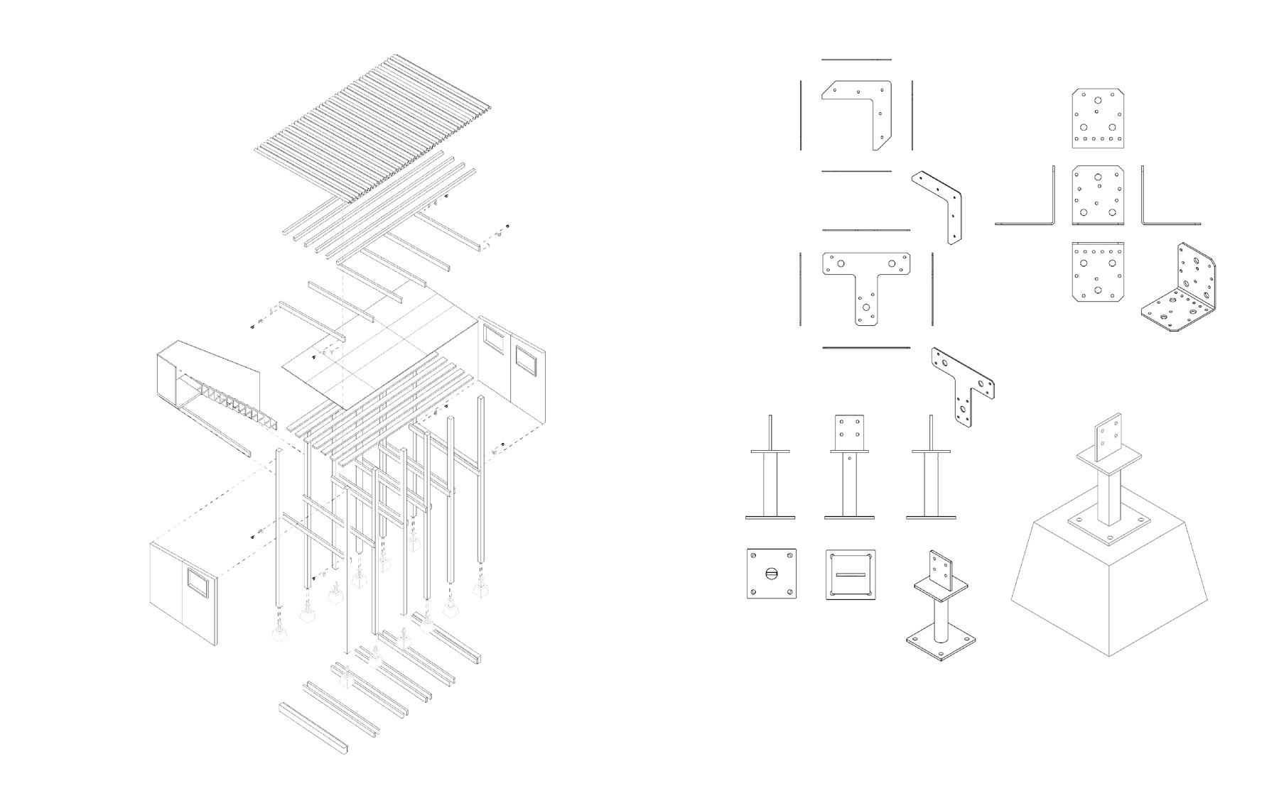
Kit of parts: the system remains open to assembly, adaptation, and local adjustment.
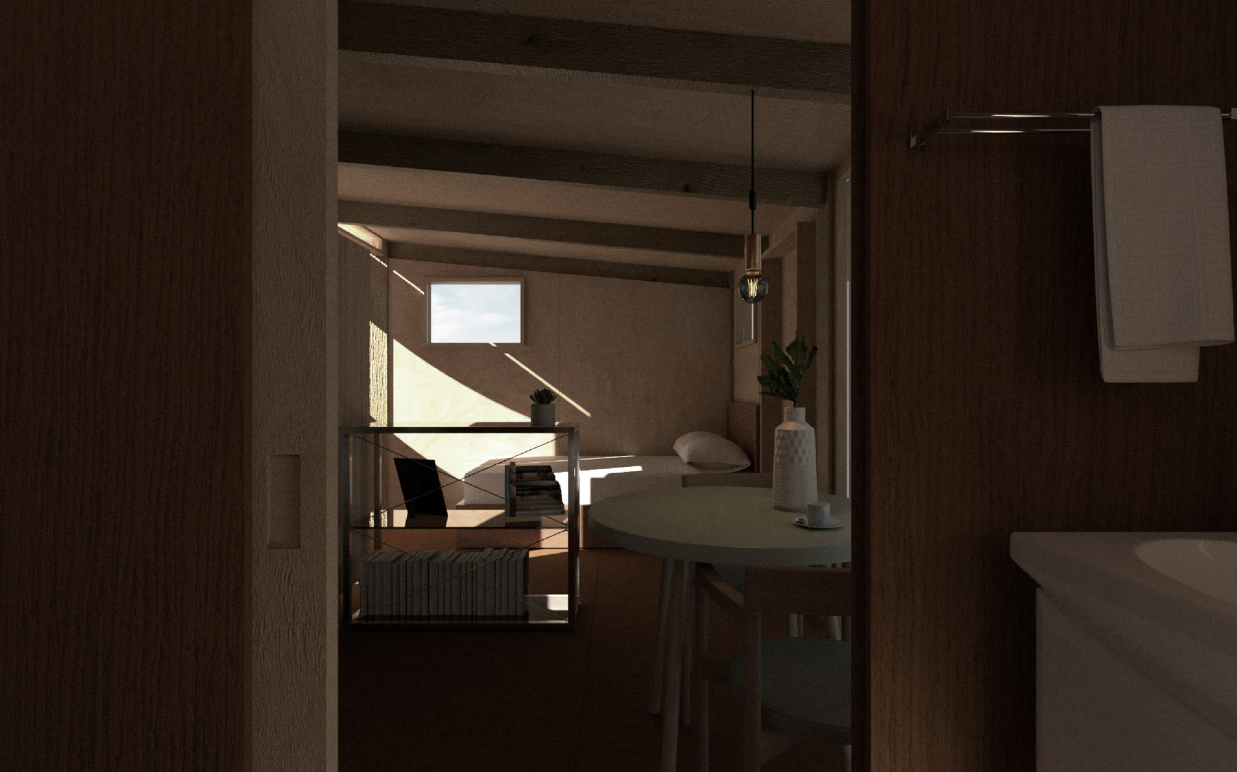
Interior condition: incremental planning is grounded in ordinary domestic occupation.
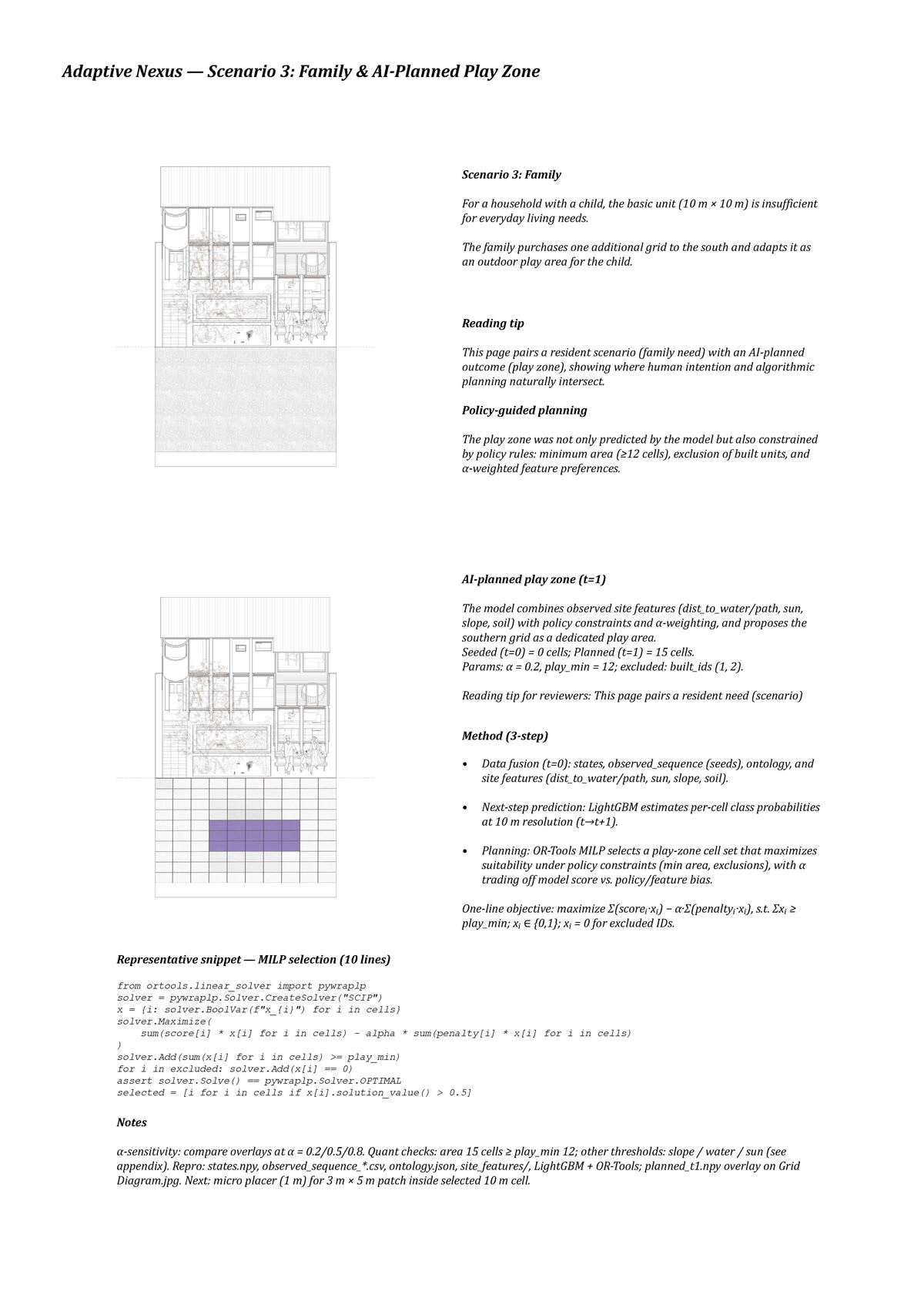
AI planning layer — a LightGBM prediction and OR-Tools selection process converts observed site features, policy constraints, and resident need into a planned play-zone proposal.
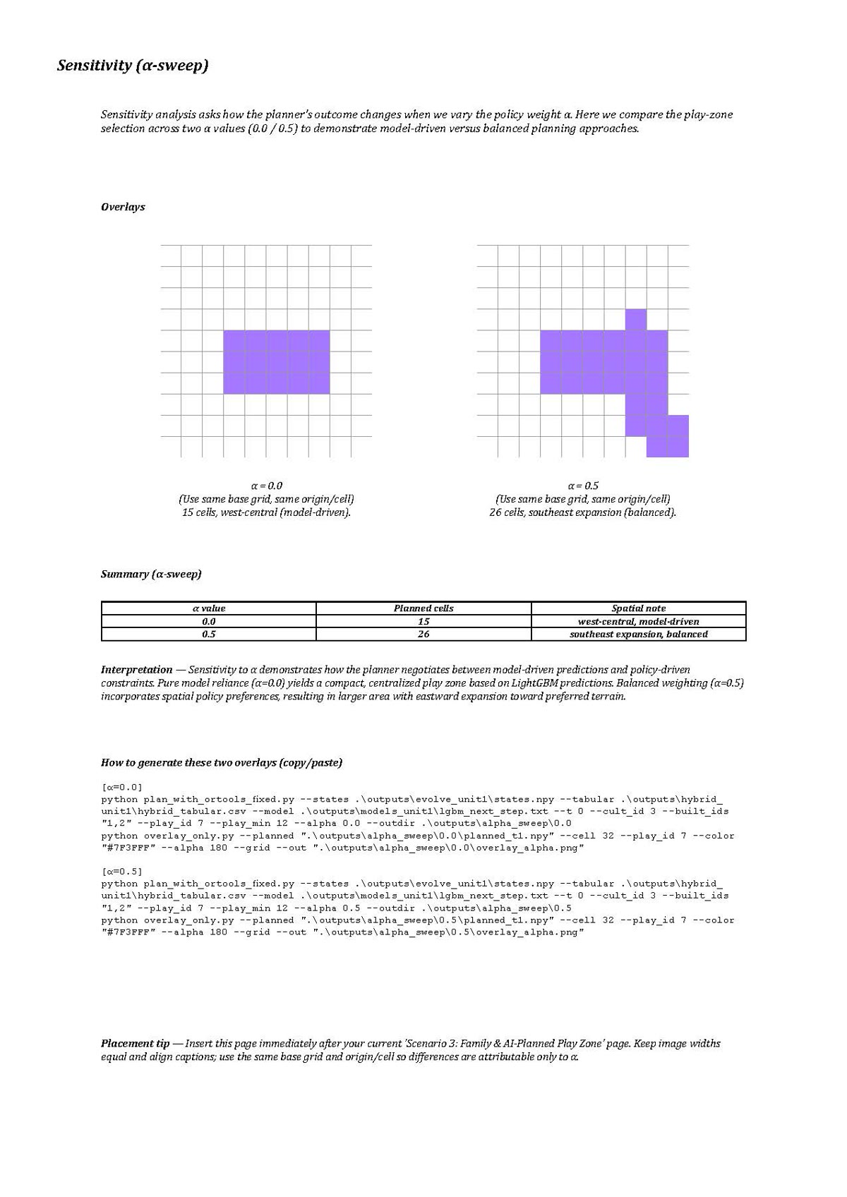
Learning process — the purple overlays show how the model shifts when policy weight changes, making AI legible as a negotiable planning method rather than a black-box answer.
Open Interactive Map
Arrival Wave Index
Live mode is recommended on a laptop.
Simulation from AWI
Live Section
Pulse Logic transforms the threshold of Nine Elms
Underground Station into an adaptive civic infrastructure. The project
begins with a custom live interactive map. Since the only data TfL makes public
is a limited "arriving in N minutes" countdown — not live vehicle positions — the project works backward
from these values, using each station's and stop's average arrival and travel times to reconstruct the
estimated positions of trains and buses along their route geometries.
Run over several weeks, this map accumulates its own dataset, from which the project derives the Arrival Wave Index (AWI) — a predictive measure of how much crowd pressure is building toward the station. The AWI lets the architecture act pre-emptively: rather than reacting after an arrival wave has landed, it reads the approaching pressure and responds in advance.
This becomes the basis for simulation across ordinary, rush-hour, disruption, and event conditions. Each simulation models how collective pressures — arrival waves, queues, dwell, heat, points of congestion — form and move across the site, and tests alternative architectural responses to them. A subsequent real-time section reconnects the same system to live data, allowing apertures, louvres, lighting, ventilation, and shared waiting spaces to change with current conditions.
At no stage does Pulse Logic track individuals; it works only with aggregated, predicted data. Instead of using AI to police or optimise movement, it makes collective urban pressure publicly legible — and leaves open a final question: who should govern this adaptive infrastructure, the AI that operates it, or the people who read and respond to it?
Run over several weeks, this map accumulates its own dataset, from which the project derives the Arrival Wave Index (AWI) — a predictive measure of how much crowd pressure is building toward the station. The AWI lets the architecture act pre-emptively: rather than reacting after an arrival wave has landed, it reads the approaching pressure and responds in advance.
This becomes the basis for simulation across ordinary, rush-hour, disruption, and event conditions. Each simulation models how collective pressures — arrival waves, queues, dwell, heat, points of congestion — form and move across the site, and tests alternative architectural responses to them. A subsequent real-time section reconnects the same system to live data, allowing apertures, louvres, lighting, ventilation, and shared waiting spaces to change with current conditions.
At no stage does Pulse Logic track individuals; it works only with aggregated, predicted data. Instead of using AI to police or optimise movement, it makes collective urban pressure publicly legible — and leaves open a final question: who should govern this adaptive infrastructure, the AI that operates it, or the people who read and respond to it?
Adaptive Nexus is an incremental live-work settlement framework for Wolverhampton's Green Belt edge. A ten-metre grid, short resident profiles and explicit site evidence are used to generate reviewable core-and-support plot families.
The current recommendation system is deterministic and non-learning. It enumerates complete two-cell bundles, removes options that violate declared constraints, compares the remaining alternatives through an ordinal priority structure and preserves exact ties for review.
A separate historical prototype used LightGBM and OR-Tools to explore cell-level play-space planning. This earlier experiment is retained as a method test. Preference learning from anonymous visitor choices remains a future research phase.
Work in progress.
The current recommendation system is deterministic and non-learning. It enumerates complete two-cell bundles, removes options that violate declared constraints, compares the remaining alternatives through an ordinal priority structure and preserves exact ties for review.
A separate historical prototype used LightGBM and OR-Tools to explore cell-level play-space planning. This earlier experiment is retained as a method test. Preference learning from anonymous visitor choices remains a future research phase.
Work in progress.